|
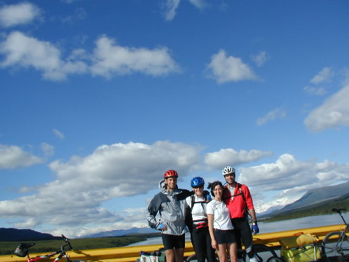
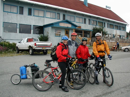
Starting out
in Cantwell at 5:00 PM.
It was a nice day, but a strong breeze made it a bit chilly.
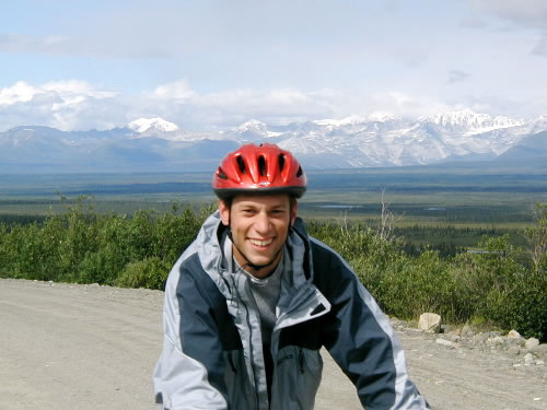
Left to right: me, Linda, Jessica Smith, Scott McArt.
Note: You can click on any of these photos for a bigger view. |

|
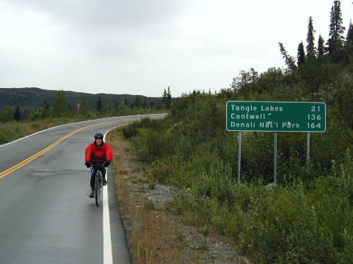
One mile down, only 135 to go to get
to Paxson. The pavement ended two miles beyond this sign and
it was dirt road from there on. |

|
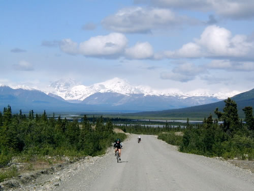
Scott and Jess head up the first climb.
We quickly found out that it was slow going. We were pedaling
at a steady, but comfortable pace. I thought we could average
10 mph. But because of lots of stops (photos, food, etc.) and
our heavy loads, we were only doing 6-7 mph. |

|
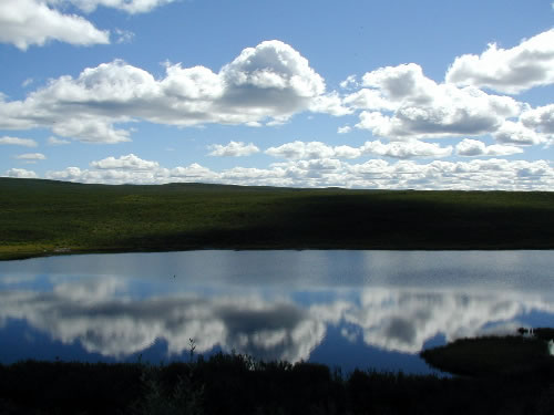
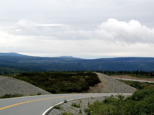
Oooh, our first great
view.
I should mention that the despite its name, the Denali Highway
is not in Denali National Park, nor does it climb up any huge
mountains. It is simply the old road that people used to get
to Denali National Park before the paved highway was built
from Anchorage.
The Denali Highway travels through the remote backcountry
of interior Alaska. It varies between 1,700 feet and 4,100
feet in elevation. But there are no huge mountain passes,
it is all wide-open tundra with views like you see here. |

|
Cruising along, feeling fresh on our
first day. I wanted to go a good distance on the first day so
that we wouldn't be overwhelmed on the next two days. I think
everyone else was kind of upset with me for pushing all the
way to Brushkana Campground (31 miles from the start). We didn't
arrive there until 9:30 and everyone was tired and hungry. I
didn't necessarily care about the campground, I just thought
we should get 30 miles or so under our belts and it was a good
target on the map. |

|
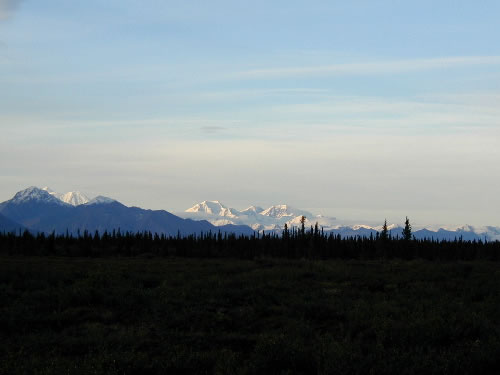
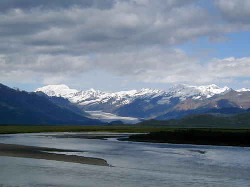
View of the Alaska Range
to the north from near the Brushkana Campground as the sun went
down on Day One. After a hot dinner of Tasty Bites, complete
with Wine & Cheese brought by Scott and Jessica, I think
everyone was back in good spirits. |

|
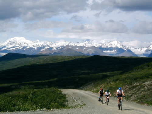
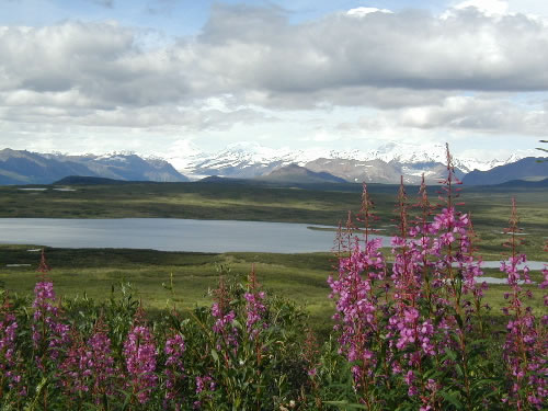
Day 2:
Every view along the road was spectacular in its own way, but
they all had a few things in common. Fireweed on the side of
the road, lakes and lush greenery in the foreground plains,
with spectacular snow-covered peaks off in the distance. We
were constantly scanning the area for wildlife, but we didn't
see much. Our guess is that this is a popular place to hunt,
so the animals know better than to be seen from the road. |

|
Linda cruises along, wishing
she had suspension on her bike for the nice washboard gravel. |

|
Scott looks like he's having
a good time, either that or he is on drugs. |

|
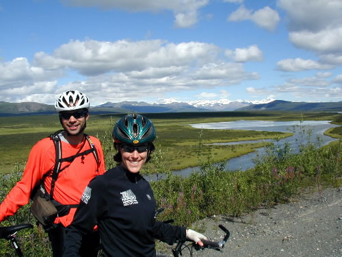
me, Jess, Scott |

|
Yeah, yeah, another stunning
view. Ho hum. |

|
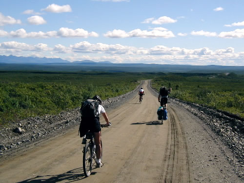
There was very little traffic
on the road. We saw probably 20 or so cars the first two days.
Weekends get a little more traffic. |

|
At mile 82, there was
a small resturant/lodge called Gracious House. This picture
was taken near there.
Linda really wanted to stop for pie (apparently it is really
good), but we kept pushing on. if I stopped for pie, I might
never leave. We did stop for pie when we drove back across
the highwya to get our Scott's car (which we left at the beginning).
Mmmm.. pie. |

|
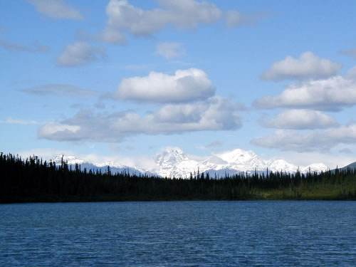
We stopped at this lake to
see a few swans (both Trumpeter and Tundra Swans according to
another observer). They were too far away for a picture. The
mountain was also far away, but it was bigger. |

|
On the bridge over the Susitna
River.
We only covered 37 miles on our second day, which was less than
we expected. We thought that we would only have to bike for
4 hours or so each day, then have time to hike & relax.
No such luck. |

|
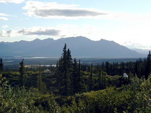
Our campsite for the second night.
Notice the two tents. It was an amazing spot. Only about 100
yards off the road, but there was no trail to the spot so it
felt extremely remote. We had views for miles in all directions,
and not a single sign of any other human activity. We couldn't
even see the road we had been biking on. |

|
View from our tent. This was one of
my five favorite camping spots ever. |

|
Cooking dinner. Our campsite was surrounded
by blueberry bushes, so when we made oatmeal the next morning,
we had plenty of fresh blueberries to add to it. Delicious! |

|
Day 3:
Big day ahead.
|

|
On the road again. We had
to cover almost fifty miles today if we were going to be able
to finish by noon tomorrow. |

|
A cool shot of the road winding
along a glacially-carved esker. These sinuous waves of silt,
rock and sand were left behind by the last ice age. |

|
Stop for lunch. |

|
Another view, another photo op. |

|
Shortly after lunch on our third day,
we came to Waterfowl Lakes. They lived up to their billing with
plenty of birds. We saw a loon and chick in this lake, but they
were too far away for a good picture. |

|
The MacLaren River, which flows from
the MacLaren Glacier in the background. Crossing the MacLaren
River meant we were about to start our biggest sustained climb
of the journey. 1,100 feet over 5 miles. |

|
Nearing the top of the climb. |

|
The sign is misleading, we actually
still had about a hundred vertical feet to climb before the
actual summit. |

|
Scott crests MacLaren Summit |

|
Another gorgeous view which
my photogrpahy skills can't do justice to. |

|
Our tent site for the third night. This was at mile
113, near Tangle Lakes. The bugs were pretty bad here. We had finished
a dinner of pasta & sauce, plus Pistascio pudding for dessert, by
about 8:00 PM, but since the bugs were so bad, we just crawled into
our tents and went to sleep while the sun was still high in the sky.
The next morning, just as we were about to leave camp, we saw our only
bear of the trip. The Grizzly was fishing in a stream, about a 1/4 mile
from our tent site.
|

|
At Tangle Lakes, we hit pavement. But
that did not mean the final 21 miles would be easy. We still
had two climbs to cover, including another 1,000 footer. Here
we have reached the top of the climb and can now cruise the
final three miles down into Paxson. If you look closely at this
picture you can see the Alaska Pipeline in the background. |

|
Crossing the finish line. Woo-hoo! |

|
Group photo before heading inside for
warm drinks and club sandwiches. |